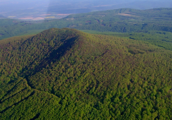
Vihorlat
With the height of 1075 MSL, it´s the highest mountain of Vihorlat mountains, whose origin is volcanic. Vihorlat is an extinct volcano. It is located approximately 20 km northeast from Michalovce. Its top is a dominant and recognizable feature visible from faraway.
Vihorlat belongs to the Protected countryside area Vihorlat, declared in 1973. It´s the smallest protected countryside area in Slovakia. The top of the mountain is a national nature reserve Vihorlat declared in 1986 on the area of 50 hectares and with the highest, fifth degree of protection. It belongs to the protection zone Vihorlatský prales (Vihorlat primeval forest), a UNESCO World Heritage-listed primeval forest (since 2007) - Ancient and Primeval Beech Forests of the Carpathians and Other Regions of Europe.
Due to its location in the military district Valaškovce, the possibility of tourist climbs is considerably limited. The official tourist trails lead to the saddle Poľana pod Vihorlatom (940 MSL), the boundary of the military district, from the villages Poruba pod Vihorlatom, Remetské Hámre, Zemplínske Hámre and Morské oko.
Mass events that offer a legal climb to Vihorlat. They have an exemption from prohibition of entrance for tourists and offer a legal way of climbing to the top: Poď na Podhoroď in may, the climb to Vihorlat of Saints Cyril and Methodius the 5th of july and the Hviezdicový climb to Vihorlat september 1st.
Foto: S-CHKO Vihorlat

